Setting geofences (Airpeak Plus exclusive)
What is a “geofence”?
Flight restrictions such as flight area or maximum altitude can be defined as geofence zones for each project.
Warnings are displayed on the flight screen in the “Airpeak Flight” App when the aircraft approaches the boundary of a geofence zone while in flight.
Geofence editing screen
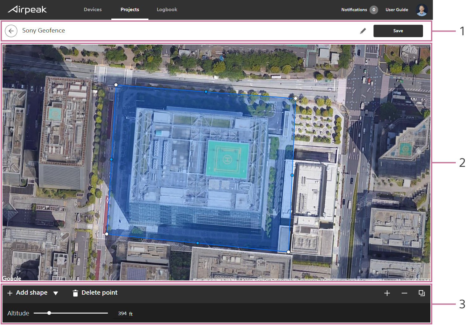
Screen may differ depending on the country/region of use and the account status.
- Title bar
- Workspace
- Toolbar
Instructions
Click on
Add geofencein theFlight planstab, and then selectCreate new geofencefrom the menu.
The geofence editing screen will be displayed.Click on
Add shapeat the bottom left of the screen and selectCircleorPolygon, and then click on the map.
A circle or polygon will appear on the map, indicating a geofence zone.Edit the geofence.
To edit a circle:
To set the radius and maximum altitude, click within the geofence zone, and then set the values at the bottom of the screen. The same maximum altitude value applies to the entire zone within a circle.
To edit a polygon:
Drag point on the edge of the geofence zone to form the desired shape.
To set the maximum altitude, click within the geofence zone, and then set the value at the bottom of the screen. The same value applies to the entire zone within a polygon.Click on
Savewhen you have completed editing. Enter the geofence name in the dialog, and then click onSave.