Managing and creating projects
What is a “project”?
The “Airpeak Base” app allows you to manage a series of workflows as a single project, from flight plans to flight logs.
This data is stored on the cloud. Data stored on the cloud can be synced to the “Airpeak Flight” app and used at the flight site.
Project list screen
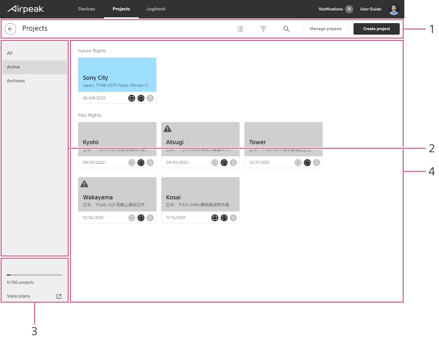
Title bar
Manage projectsallows you to archive projects that are no longer needed.
Archived projects can be displayed by selectingAllorArchivesin the project status filter.Project status filter
Number of projects
Project list
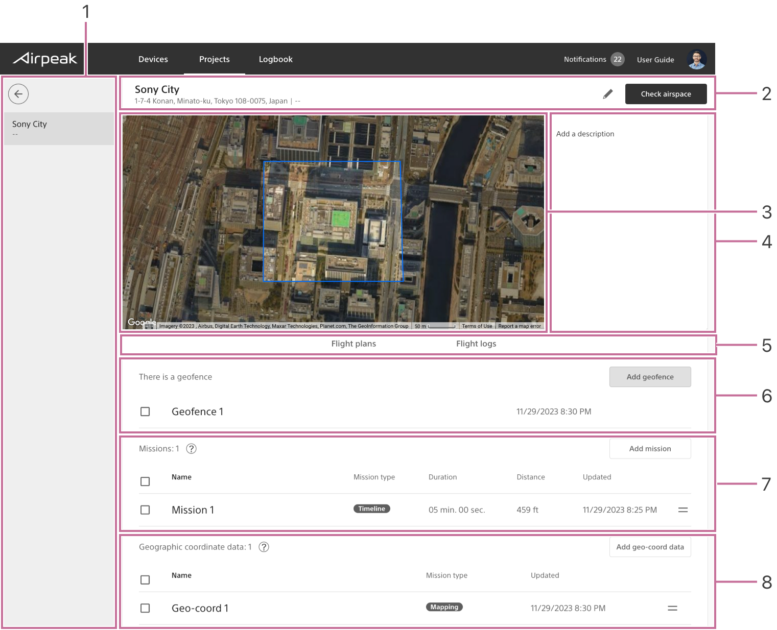
Projects screen
Screen may differ depending on the country/region of use and the account status.
Screen may differ depending on the country/region of use and the account status.
- Project list
- Title bar
- Project preview
- Project details panel
- Tabs for switching between flight plans and flight logs
- Geofences
- Missions list
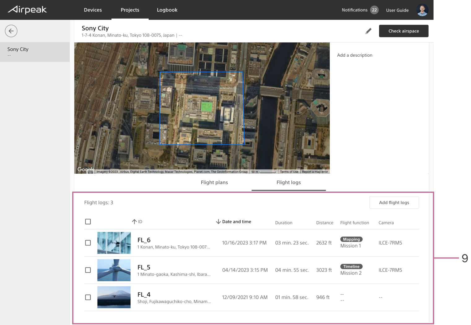
- Flight logs list
Creating a project
Instructions
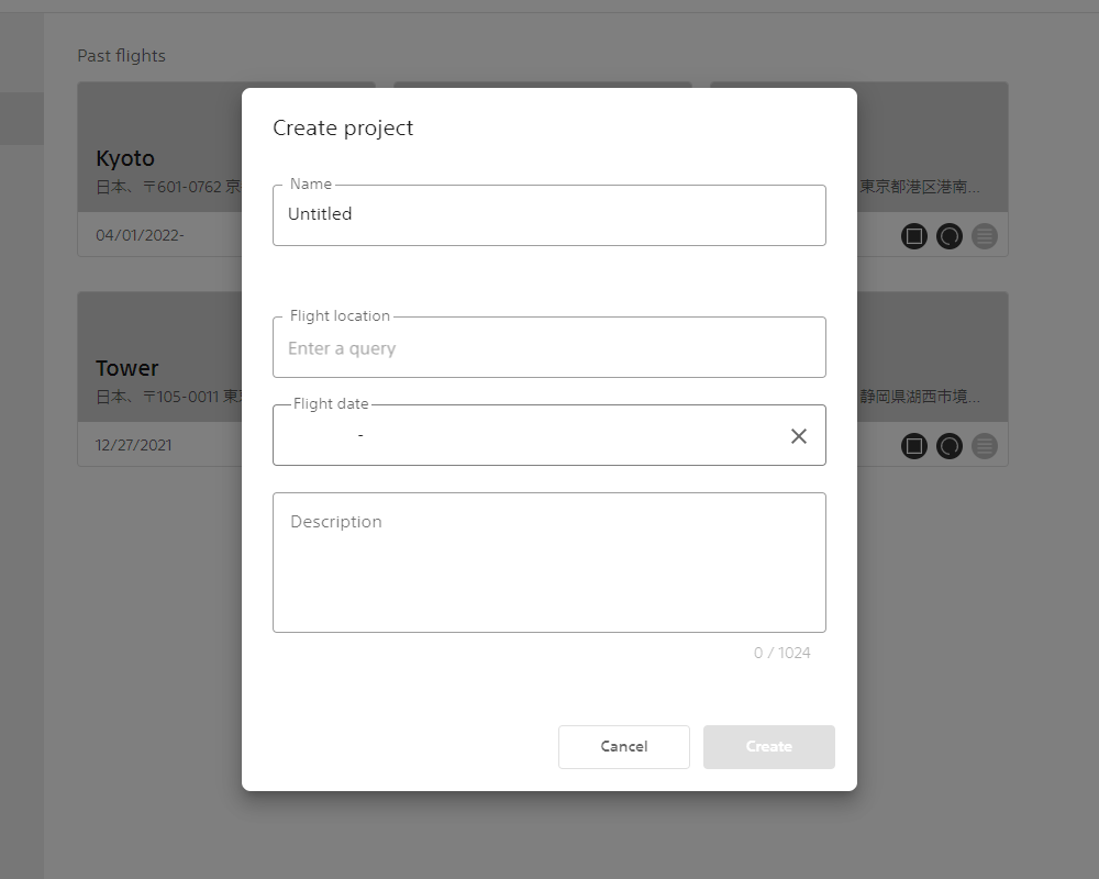
- Click on
Create projecton the project list screen. - Enter the project name, flight location, and other information into the dialog box and click
Create.
About data types
The type of data saved varies depending on the type and format of the file you import. If you import a file including keyframes, the mission will be saved. If you import a file including specified area, geographic coordinate data is saved.
Mission
Contents of data
Contains information about the flight path and the operation of the aircraft and camera (flight speed, shooting timing, etc.).
How to use
Open this data from Airpeak Flight and use it for mission.
Geographic coordinates data
Contents of data
Contains only mapping area information. It does not include information regarding the operation of the aircraft or camera (flight speed, shooting timing, etc.).
How to use
Open this data from Airpeak Flight and use it by creating a mapping mission.